

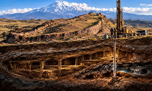
For decades, one of the most intriguing archaeological mysteries in the biblical world has been sitting in the mountains of eastern Turkey.
From the air, it looks remarkably like the outline of a massive ship.
Its length is approximately 515 feet. It sits in the region traditionally associated with Noah’s Ark. Radar investigations have detected unusual linear features and voids beneath the surface. And researchers have spent years arguing over whether the Durupınar formation is simply an extraordinary geological coincidence — or the remains of something far more significant.
Now, for perhaps the first time, the argument is moving beyond photographs and radar screens.
Researchers have drilled deep inside the formation.
And almost immediately, they encountered something they weren’t expecting.
A Different Kind Of Ark Expedition
The 2026 investigation is significant because this is not simply another group of amateur Ark hunters walking across the mountains looking for pieces of wood.
The project is directed by Prof. Dr. Cenker Atila of the Department of Archaeology at Sivas Cumhuriyet University in cooperation with Noah’s Ark Scans, and has received official authorization from Turkish authorities. The investigation includes GPS mapping, three-dimensional modeling, ground-penetrating radar, electrical-resistivity studies, soil sampling and now deep core drilling.
The Durupınar formation was identified from aerial photographs in 1959. Measuring approximately 157 meters — 515 feet — from end to end, its enormous boat-like outline has fascinated researchers ever since.
Genesis describes Noah’s Ark as 300 cubits long. The precise length depends upon which ancient cubit measurement is used, but proponents have long argued that Durupınar falls strikingly close to plausible biblical dimensions.
More importantly, Genesis does not say the Ark landed on the summit of Mount Ararat.
It says the Ark rested “upon the mountains of Ararat.”
Durupınar lies roughly 20 miles south of Mount Ararat, within that broader region.
For years, however, appearances could only take the argument so far.
Critics maintained that Durupınar was simply a natural geological formation.
So researchers finally decided to look underneath it.
var images = [],
index = 0;
images[0] = ““;
images[1] = ““;
images[2] = ““;
images[3] = ““;
index = Math.floor(Math.random() * images.length);
document.write(images[index]);
//done
They Drilled Nearly 60 Feet Down
The current expedition has drilled both inside and outside the boat-shaped formation, recovering core samples from depths reaching approximately 18 meters — nearly 60 feet.
The comparison is important. Samples taken outside the formation can provide a geological control against which material recovered from inside can be tested.
According to the research team, the drilling has already produced an intriguing result: they report recovering organic-rich layers and encountering multiple underground cavities, while saying that the holes drilled inside the formation have so far failed to encounter the continuous solid limestone or bedrock some geological explanations would predict.
Then one drill hit something else.
At approximately four to five meters beneath the surface, after drilling through the overlying material, the equipment encountered an extremely hard layer.
The drill bit broke.
Researchers have raised the possibility that the material could be petrified or heavily mineralized wood.
But that distinction is important: they do not yet know what it is.
Samples are being sent for laboratory testing. Until those tests are completed, “petrified wood” remains a hypothesis rather than a discovery.
Yet even without knowing what broke the drill, what researchers are encountering underground is making Durupınar more interesting rather than less.
The Cavities May Be Even More Important
The broken drill bit makes a spectacular headline.
The underground spaces may ultimately prove more important.
Previous geophysical investigations reportedly detected linear features, right-angle intersections, elongated voids and anomalies that researchers have interpreted as possible corridors or chamber-like spaces.
Now drilling has physically encountered cavities beneath the formation. In at least one case, researchers reported penetrating a void containing mud and water.
That doesn’t prove someone constructed those spaces. Natural geological processes can create cavities and unusual subsurface formations.
But it gives researchers something tangible to investigate.